


2 March 2023

02-03-2023
12:00:AM
1241 Views
Table of Contents
|
Coral reefs damaged: What’s the big deal?
GS-3:Conservation, environmental pollution and degradation, environmental impact assessment.
The current condition of corals is concerning as they appear to be in poor health. The primary reason behind coral bleaching events is the rising oceantemperature caused by climate change. During these events, the reefs expel the algae responsible for their vibrant color, which can eventually lead to the death of corals if it continues for an extended period.
Over the past thirty years, around half of the world's shallow watercorals have already been lost, and if the current rate continues, up to 90% of them could disappear by the middle of this century. This is a significant issue, and not just because it would result in fewer posts from the Great Barrier Reef on BeReal.

Corals and coral reefs
- Coral reefs are diverse ecosystems made up of coral polyps, tiny living creatures that can take many forms and are held together by calcium carbonate.
- Thousands of coral species have been discovered, with some living in warm, shallow, tropical seas and others in the cold, dark depths of the ocean.
- Coral reefs are known as the "rainforests of the sea" due to the diversity of life found in their habitats.
- About 25% of the ocean's fish depend on healthy coral reefs for shelter, food, reproduction, and raising their young.
- Coral reefs occupy just 0.1% of the ocean's surface but are home to 25% of marine species.
- The largest coral reef system is the Great Barrier Reef in Australia, which is more than 1,500 miles long and is mostly found in clear, shallow waters of the tropics and subtropics.
- Coral reefs are usually found in shallow areas less than 150 feet deep, but some can extend up to about 450 feet.
Coral characteristics

- Shallow water, reef-building corals have a mutualistic relationship with photosynthetic algae called zooxanthellae.
- The coral provides a protected environment and compounds for photosynthesis while the algae produce carbohydrates for food and oxygen, and help remove waste.
- The symbiotic relationship between shallow water corals and zooxanthellae is called mutualism.
- Deep-sea corals, which live in deeper or colder waters, do not have zooxanthellae.
- Unlike shallow water corals, deep-sea corals rely on plankton and organic matter for much of their energy needs.
- Deep-sea corals do not heavily rely on photosynthesis to produce food.
Factors Affecting Coral Reefs
- Extreme climate conditions: High water temperature is not suitable for coral reefs, and scientists estimate that the increasing rate of ocean warming will lead to the decline of most coral reefs worldwide.
- Coral reefs cannot survive in high temperature.
- Overfishing: Overfishing is leading to an ecological imbalance of coral reefs.
- Coastal development: Construction of coastal infrastructure and tourist resorts near coral reefs causes significant damages.
- Pollution: Direct dumping of toxic pollutants into the ocean can increase nitrogen levels, leading to an overgrowth of algae and poisoning of coral reefs.
- Sedimentation: Soil erosion from construction along coasts and islands can increase sediment in rivers and smother coral reefs by depriving them of the light needed to survive.
Growth Conditions for Coral Reefs
- Water temperature: Coral reefs require a water temperature between 23°C to 25°C for optimal growth, and the temperature should not exceed 35°C.
- Salinity: Coral reefs can only survive under saline conditions with an average salinity between 27% to 40%.
- Water depth: Coral reefs grow better in shallow water, with a depth less than 50m and should not exceed 200m.
Types of corals

Fringing Reef
- These are coral reefs that are located close to the shore and create a shallow lagoon known as a Boat Channel.
- They typically develop along islands and continental margins, growing from the sea bottom with a steep slope towards the deep sea.
- Fringing Reefs are the most commonlyfound coral reefs and examples include Sakau Island in New Hebrides and the South Florida Reef.
Barrier Reef
- These are the largest, highest, and widest reefs among the three types.
- They grow parallel to the shore and off the coast, forming a broken and irregular ring.
- Barrier Reefs can extend for over 100 km and can be several kilometers wide.
- The Great Barrier Reef of Australia is an example of a Barrier Reef and is over 1200 miles long.
Atolls
- An atoll is a roughly circularreef that surrounds a central lagoon with a depth of 80-150 meters.
- These reefs are located away from deep sea platforms and can be found around an island or on a submarine platform in an elliptical form.
- Examples of atolls include Fiji Atolls, Suvadivo in Maldives, and Funafoothis Atoll of Ellice.
Benefits and Importance of Coral Reefs
- Coral reefs provide natural protection to coastlines from storms and erosion, as well as habitats and shelter for marine organisms.
- They are a significant source of food, income, and protection for over half a billion people worldwide.
- Fishing, diving, and snorkeling on and near reefs contribute hundreds of millions of dollars to local businesses and economies.
- Coral reefs are culturally important to indigenous people around the world.
- They are the source of nitrogen and other essential nutrients for marine food chains, assist in carbon and nitrogen-fixing, and aid in nutrient recycling.
- Coral reefs serve as scientifically testable records of climatic events over the past million years.
- The fishing industry depends on coral reefs, as many fish spawn there, and juvenile fish spend time there before making their way to the open sea. The Great Barrier Reef generates over 1.5 billion dollars annually for the Australian economy from fishing and tourism.
- Coral reefs are key indicators of global ecosystem health and serve as an early warning sign of what may happen to other less sensitive systems, such as river deltas if climate change is not urgently addressed.
Coral Reefs in India

- India has a coastline of 7500km but has few coral reefs due to subtropical climatic conditions.
- Major coral reefs in India include Palk Bay, Gulf of Mannar, Gulf of Kutch, Andaman and Nicobar Islands, and Lakshadweep Islands.
- Lakshadweep reef is an atoll while the rest are fringing reefs.
- Palk Bay: It has one fringing reef that is 25-30km long, less than 200m wide, and has a maximum depth of 3m.
- The Gulf of Mannar: It lies between Tuticorin and Rameswaram and includes a chain of 21 islands forming the Mannar Barrier Reef which is 140km long and 25km wide.
- Andaman and Nicobar Islands: It consist of 350 islands, of which only 38 are inhabited, and are almost entirely fringing reefs.
- The Gulf of Kutch: It is in the northern part of the Saurashtra Peninsula and has fringing reefs about 170km long and 75km wide at the mouth, but they are highly degraded due to mud deposits.
- Lakshadweep Islands: It consist of 36 tiny islands, 12 atolls, 3 reefs, and 5 submerged banks, covering an area of 32km2 with lagoons occupying 4200km2.The water temperature in Lakshadweep Islands ranges from 28-31°C with salinity ranging from 34% - 37%.
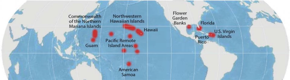
Coral Reefs around the world
Threats to coral reef ecosystems
- Coral reef ecosystems face natural threats such as diseases, predators, and storms, as well as threats caused by people like pollution, sedimentation, unsustainable fishing practices, and climate change.
- Many of these threats can stress corals, leading to coral bleaching and possible death, while others cause physical damage to the ecosystems.
- During the 2014-2017 coral bleaching event, warm waters affected 70% of coral reef ecosystems worldwide, and some areas, like the Great Barrier Reef in Australia, were hit particularly hard.
- 20% of the world's coral reefs have been destroyed, 24% are at high risk of collapse, and another 26% at risk from long-term collapse due to human activities.
- Over-fishing, destructive fishing practices, marine pollution, poorly managed tourism, global warming, and invasive alien species are all threats to coral reefs.
- Coral reefs can recover from bleaching events if conditions improve before they die, but it can take many years for the ecosystems to fully heal.
Coral Bleaching

- Coral and zooxanthellae have a symbiotic relationship where the algae transfer 90% of their nutrients to the coral host.
- Severe environmental stress can cause the loss of symbiotic algae, resulting in coral bleaching.
- Coral bleaching makes the white calcium-carbonateexoskeleton visible through transparent tissue.
- Without algae, corals become vulnerable and may die if the sea temperature remains high for weeks.
Ways to protect
- Local restoration efforts through coral transplantation
- Establishment of marine protected areas like national parks
- Prevention of run-off from agricultural and effluent sources
- Addressing climate change, which is the biggest threat
- Reduction of emissions for long-term survival of coral reefs
- Prevention of over-harvesting through legislation
- Monitoring of coral reefs for effective management strategies
- Building awareness about coral reefs and their services to mitigate threats
- Supporting participation and sustainable livelihoods in reef-dependent communities.
The case for open, verifiable forest cover data
GS-3:Conservation, environmental pollution and degradation, environmental impact assessment.
India is one of the few nations to have comprehensive approach to forest assessment. India has implemented a scientific method for periodic evaluation of forest cover, which is useful for planning, policy formulation, and decision-making based on evidence. Over the years, India's forest cover has increased from 19.53% in the early 1980s to 21.71% in 2021. In addition, there is an estimated 2.91% tree cover in 2021, bringing the total green cover in the country to 24.62% on paper.

India's Systematic Approach to Forest Assessment

Mapping India's Forest Cover
- The Forest Survey of India (FSI)has been mapping India's forest cover since the early 1980s.
- India counts all plots of 1 hectare or above, with at least 10% tree canopydensity, within forest cover, regardless of land use or ownership.
- This differs from the United Nation's benchmark that does not include areas predominantly under agricultural and urban land use in forests.
- All land areas with tree canopy density of 40% and above are considered dense forests, and those between 10-40% are open forests.
- A new category, very dense forest, was assigned to land with 70% or more canopy density since 2003.
Notional Area under Tree Cover
- Since 2001, isolated or small patches of trees, less than 1 hectare and not counted as forest, are assessed.
- These patches are combined to determine a notional area under tree cover by putting together the crowns of individual patches and trees.
The History of India's Forest Cover Assessment
- The Governmentrecords show that 42,380 sq km of forest land was diverted for non-forest use between 1951 and 1980 but the reliable data on encroachment is unavailable.
- The National Remote Sensing Agency (NRSA) used satellite imagery to estimate India's forest cover for periods 1971-1975 and 1980-1982 and reported a loss of 2.79% in just seven years, from 16.89% to 14.10%.
- However, the government was reluctant to accept the reported loss of forest cover, and after negotiations, the NRSA and the newly established FSI "reconciled" India's forest cover at 19.53% in 1987.
- Though, the FSI did not contest the NRSA finding that dense forest cover had fallen from 14.12% in the mid-1970s to 10.96% in 1981, and reconciled it to 10.88% in 1987.
Evolution of Forest Cover Assessment in India
Early Assessments
- Until the mid-1980s, forest cover in India was estimated using satellite images at a 1:1 million scale.
- The scale improved to 1:250,000 by 2001, reducing the minimum mappable unitsizefrom 400 to 25 hectares.
Impact of Improved Scale
- The refinement of the scale resulted in the forest cover fallingwithin the forest area while it increasedoutside.
- It made possible to discern several small non-forested or degraded forest patches within the forest land that earlier appeared as a larger green chunk. Similarly, small woodlots or plantations outside forest areas became visible.
- The forest cover data has been revised in every successivereport since the refinement of the scale in 2001.
Forest Areas in India
Recorded Forest Area
- In India, Recorded Forest Area is the land recorded as forest in revenue records or proclaimed as forest under a forest law.
- It accounts for 23.58% of India's land area.
- These areas were recorded as forests due to the presence of forests on the land.
- They are divided into Reserved, Protected and Unclassed forests.
Loss in Recorded Forest Areas over time
- Over time, some Recorded Forest Areas lost forest cover due to encroachment, diversion, forest fires, etc.
- In many places outside the Recorded Forest Areas, tree cover improved due to agro-forestry, orchards, etc.
- In 2011, the FSI furnished data on India's forest cover inside and outside Recorded Forest Areas.
- Nearly one-third of Recorded Forest Areas had no forest at all, which means over 2.44 lakh sq km or 7.43% of India's old natural forests were already gone.
- Decrease in density of forests in Recorded Forest Areas and only a small portion of the Recorded Forest Areas is composed of dense forests.
India's Forest Cover: Loss of Dense Forests and Plantations
- Only 9.96% of India was covered by dense forests within Recorded Forest Areas in 2021, despite extensive plantation efforts by the forest department since the 1990s, which represents a decline from 10.88% in 1987.
- Commercial plantations, orchards, village homesteads, and urban areas are included as dense forests outside of Recorded Forest Areas, masking the loss of natural forests.
- The State of Forest Report 2021 reports 12.37% dense forestcover by including such random green patches.
- The FSI has not provided specific information on the share of plantations in the remaining dense forests inside Recorded Forest Areas, but experts say much of the 20,000 sq km of forest loss compensated by 11,000 sq km of newly dense forest areas are plantations.
- Natural forests do not grow so fast, indicating that these are indeed plantations.
Key differences between natural forest and manmade plantation
- Biodiversity: Natural forests are diverse and support a wide range of flora and fauna, while plantations are typically monoculture and have much lower biodiversity.
- Resilience: Natural forests are typically more resilient to fires, pests, and epidemics due to their greater biodiversity and complex ecosystem. Plantations, on the other hand, are more vulnerable to these threats.
- Carbon storage: Natural forests store large amounts of carbon in their trees and soil, while plantations may take several decades to reach similar levels of carbon storage.
- Harvesting: Plantations are often harvested more readilythan natural forests, which can undermine efforts to reduce carbon emissions and preserve biodiversity.
- Growth rate: Plantations tend to grow faster than natural forests due to the use of genetically modified trees and intensive management practices.
- Ecosystem services: Natural forests provide a wide range of ecosystem services, including regulating water cycles, preventing soil erosion, and supporting local communities. Plantations typically provide fewer ecosystem services, and those that they do provide are often focused on timber production.
Encouraging Open and Participatory Approaches for Forest Data Verification
- The FSI claims to have achieved a 95.79% accuracy in identifying forests from non-forests by comparing its interpreted data with ground reference data collected under the National Forest Inventory programme.
- However, the exercise was limited to less than 6,000 sample points and the FSI has not made its data available for public scrutiny or allowed the media access to its geo-referenced maps.
- In contrast, Brazil's National Institute for Space Research maintains an open platform for queries, analysis, and dissemination of data on deforestation and forest cover change.
- Experts suggest that making the FSI's field data freely available to the public could ease its burden and allow thousands of researchers and enthusiasts to volunteer in verifying the country's forest data on the ground.
Comments
Login To Comment
Recent Comments